
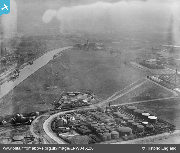
EPW045126 ENGLAND (1934). Land next to Wharf 60, Trafford Park, from the south-west, 1934
© Copyright OpenStreetMap contributors and licensed by the OpenStreetMap Foundation. 2026. Cartography is licensed as CC BY-SA.
Nearby Images (8)
EPW045126

EPW045127

EPW027472

EPW027486

EPW027470

EPW060419

EPW016586

EPW016586
Details
| Title | [EPW045126] Land next to Wharf 60, Trafford Park, from the south-west, 1934 |
| Reference | EPW045126 |
| Date | July-1934 |
| Link | |
| Place name | TRAFFORD PARK |
| Parish | |
| District | |
| Country | ENGLAND |
| Easting / Northing | 377490, 397572 |
| Longitude / Latitude | -2.3391779124246, 53.474144201292 |
| National Grid Reference | SJ775976 |
Pins
Be the first to add a comment to this image!