
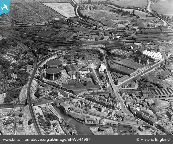
EPW044987 ENGLAND (1934). The Worcester New Gas Light Co Works and the Worcester Engineering Works, Worcester, 1934
© Copyright OpenStreetMap contributors and licensed by the OpenStreetMap Foundation. 2026. Cartography is licensed as CC BY-SA.
Nearby Images (15)
EPW044987

EPW044989

EPW044990

EPW044986

EAW000695

EAW000697

EPW044988

EAW000691

EAW000694

EPW044991

EAW000693

EPW044985

EPW001299

EAW000692

EAW000696

Details
| Title | [EPW044987] The Worcester New Gas Light Co Works and the Worcester Engineering Works, Worcester, 1934 |
| Reference | EPW044987 |
| Date | June-1934 |
| Link | |
| Place name | WORCESTER |
| Parish | |
| District | |
| Country | ENGLAND |
| Easting / Northing | 385570, 255377 |
| Longitude / Latitude | -2.2111388402947, 52.196037007062 |
| National Grid Reference | SO856554 |
Pins

elltrain3 |
Tuesday 2nd of June 2026 12:22:59 AM | |
|
kiwizzarrd |
Monday 21st of February 2022 03:53:40 PM | |
|
PAUL |
Wednesday 7th of July 2021 12:17:07 PM | |
|
peter stuart legat |
Monday 5th of April 2021 05:03:06 PM | |
|
peter stuart legat |
Monday 5th of April 2021 05:00:57 PM | |
|
Cowshed |
Friday 15th of November 2013 09:20:58 PM | |
|
Cowshed |
Friday 15th of November 2013 09:19:16 PM | |
|
Cowshed |
Friday 15th of November 2013 09:18:33 PM | |
|
Cowshed |
Friday 15th of November 2013 09:17:29 PM | |
|
Cowshed |
Friday 15th of November 2013 09:16:32 PM |