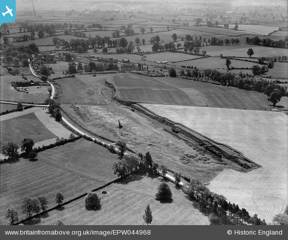
EPW044968 ENGLAND (1934). A Romano British burial ground site and surrounding countryside, Bloxham, 1934
© Copyright OpenStreetMap contributors and licensed by the OpenStreetMap Foundation. 2026. Cartography is licensed as CC BY-SA.
Nearby Images (5)
Details
| Title | [EPW044968] A Romano British burial ground site and surrounding countryside, Bloxham, 1934 |
| Reference | EPW044968 |
| Date | June-1934 |
| Link | |
| Place name | BLOXHAM |
| Parish | BLOXHAM |
| District | |
| Country | ENGLAND |
| Easting / Northing | 442206, 235828 |
| Longitude / Latitude | -1.3848849210624, 52.018843872488 |
| National Grid Reference | SP422358 |
Pins

Ged |
Wednesday 20th of September 2023 05:31:51 PM | |

Ged |
Wednesday 20th of September 2023 05:31:20 PM | |

Ged |
Wednesday 12th of October 2022 03:32:20 PM | |

John W |
Tuesday 20th of December 2016 05:57:11 PM | |

Class31 |
Wednesday 6th of May 2015 08:47:37 AM |


![[EPW044968] A Romano British burial ground site and surrounding countryside, Bloxham, 1934](http://britainfromabove.org.uk/sites/all/libraries/aerofilms-images/public/100x100/EPW/044/EPW044968.jpg)
![[EPW044970] A Romano British burial ground site and surrounding countryside, Bloxham, 1934](http://britainfromabove.org.uk/sites/all/libraries/aerofilms-images/public/100x100/EPW/044/EPW044970.jpg)
![[EPW044969] A Romano British burial ground site, the village and surrounding countryside, Bloxham, 1934](http://britainfromabove.org.uk/sites/all/libraries/aerofilms-images/public/100x100/EPW/044/EPW044969.jpg)
![[EPW044967] A Romano British burial ground site and surrounding countryside, Bloxham, 1934](http://britainfromabove.org.uk/sites/all/libraries/aerofilms-images/public/100x100/EPW/044/EPW044967.jpg)
![[EPW044966] A Romano British burial ground site and surrounding countryside, Bloxham, 1934](http://britainfromabove.org.uk/sites/all/libraries/aerofilms-images/public/100x100/EPW/044/EPW044966.jpg)