
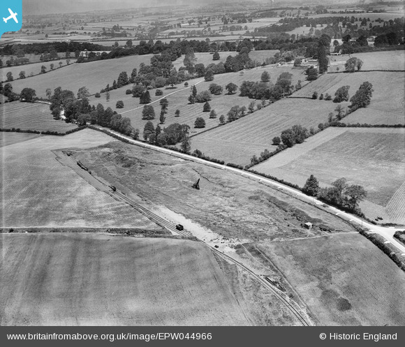
EPW044966 ENGLAND (1934). A Romano British burial ground site and surrounding countryside, Bloxham, 1934
© Copyright OpenStreetMap contributors and licensed by the OpenStreetMap Foundation. 2026. Cartography is licensed as CC BY-SA.
Nearby Images (4)
EPW044966

EPW044970

EPW044968

EPW044969

Details
| Title | [EPW044966] A Romano British burial ground site and surrounding countryside, Bloxham, 1934 |
| Reference | EPW044966 |
| Date | June-1934 |
| Link | |
| Place name | BLOXHAM |
| Parish | BLOXHAM |
| District | |
| Country | ENGLAND |
| Easting / Northing | 442175, 235983 |
| Longitude / Latitude | -1.3853175884545, 52.020239865181 |
| National Grid Reference | SP422360 |
Pins

Ged |
Sunday 27th of March 2022 02:03:36 PM | |
|
Ged |
Sunday 27th of March 2022 02:02:53 PM | |
|
Ged |
Sunday 27th of March 2022 02:01:43 PM | |

Class31 |
Wednesday 6th of May 2015 08:46:27 AM |