
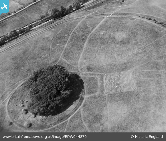
EPW044870 ENGLAND (1934). St Catherine's Hill hillfort and the maze, St Catherine's Hill, 1934
© Copyright OpenStreetMap contributors and licensed by the OpenStreetMap Foundation. 2025. Cartography is licensed as CC BY-SA.
Nearby Images (2)
EPW044870

EAW022268

Details
| Title | [EPW044870] St Catherine's Hill hillfort and the maze, St Catherine's Hill, 1934 |
| Reference | EPW044870 |
| Date | June-1934 |
| Link | |
| Place name | ST CATHERINE'S HILL |
| Parish | |
| District | |
| Country | ENGLAND |
| Easting / Northing | 448415, 127712 |
| Longitude / Latitude | -1.3092732785486, 51.046180354619 |
| National Grid Reference | SU484277 |
Pins
Be the first to add a comment to this image!