
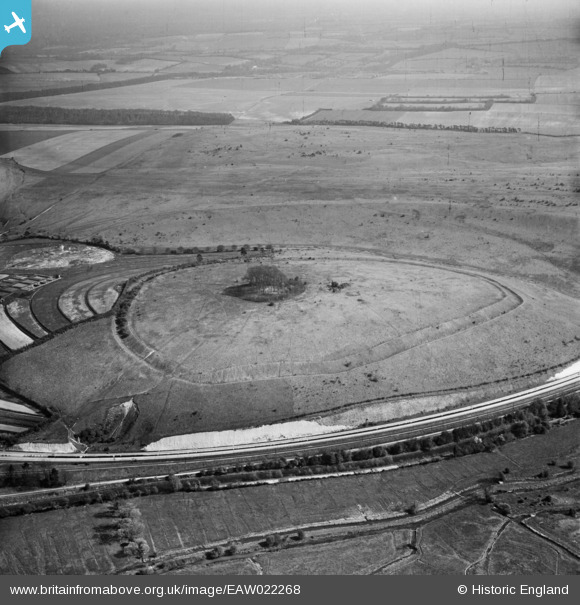
EAW022268 ENGLAND (1949). St Catherine's Hill hillfort, Winchester, 1949
© Copyright OpenStreetMap contributors and licensed by the OpenStreetMap Foundation. 2025. Cartography is licensed as CC BY-SA.
Nearby Images (2)
EAW022268

EPW044870

Details
| Title | [EAW022268] St Catherine's Hill hillfort, Winchester, 1949 |
| Reference | EAW022268 |
| Date | 17-May-1949 |
| Link | |
| Place name | WINCHESTER |
| Parish | |
| District | |
| Country | ENGLAND |
| Easting / Northing | 448407, 127639 |
| Longitude / Latitude | -1.3093971657192, 51.045524572729 |
| National Grid Reference | SU484276 |
Pins

MB |
Tuesday 31st of December 2013 10:55:13 AM |
User Comment Contributions
The beech copse grows on the site of the twelfth-century chapel which was dedicated to St Catherine |
MB |
Tuesday 31st of December 2013 10:52:25 AM |