
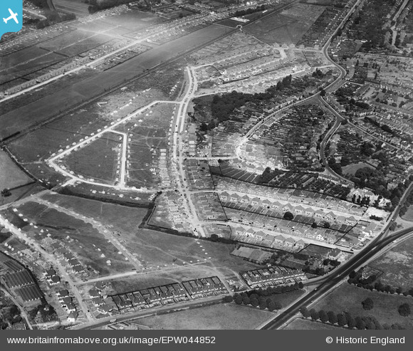
EPW044852 ENGLAND (1934). Housing under construction along Harland Avenue, Brooklands Avenue and environs, Sidcup, 1934
© Copyright OpenStreetMap contributors and licensed by the OpenStreetMap Foundation. 2026. Cartography is licensed as CC BY-SA.
Nearby Images (4)
EPW044852

EPW044388

EPW044390

EPW044853

Details
| Title | [EPW044852] Housing under construction along Harland Avenue, Brooklands Avenue and environs, Sidcup, 1934 |
| Reference | EPW044852 |
| Date | June-1934 |
| Link | |
| Place name | SIDCUP |
| Parish | |
| District | |
| Country | ENGLAND |
| Easting / Northing | 544987, 172543 |
| Longitude / Latitude | 0.086003902875523, 51.432820706622 |
| National Grid Reference | TQ450725 |
Pins

Albion |
Saturday 22nd of July 2023 01:18:05 PM | |
|
Ratways |
Wednesday 21st of January 2015 03:58:26 PM | |
 |
Mike Floate |
Monday 23rd of December 2013 08:00:56 PM |