
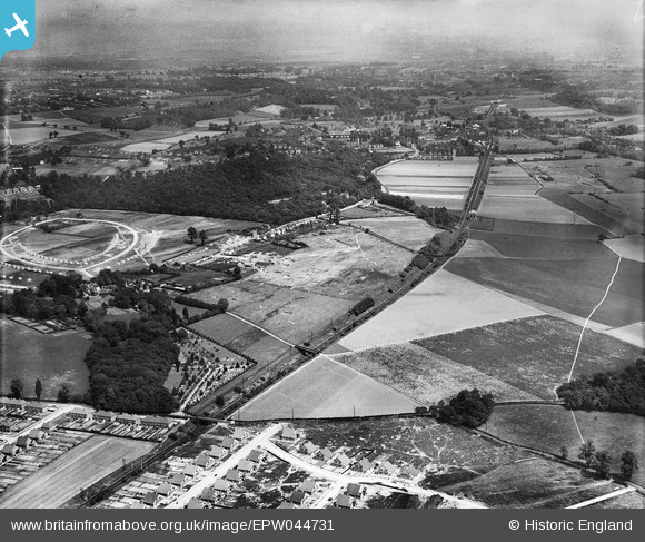
EPW044731 ENGLAND (1934). The SR Dartford Loop Line and environs, Sidcup, from the south-west, 1934
© Copyright OpenStreetMap contributors and licensed by the OpenStreetMap Foundation. 2026. Cartography is licensed as CC BY-SA.
Nearby Images (2)
EPW044731

EPW038430

Details
| Title | [EPW044731] The SR Dartford Loop Line and environs, Sidcup, from the south-west, 1934 |
| Reference | EPW044731 |
| Date | June-1934 |
| Link | |
| Place name | SIDCUP |
| Parish | |
| District | |
| Country | ENGLAND |
| Easting / Northing | 547663, 172783 |
| Longitude / Latitude | 0.1245768105857, 51.434286269299 |
| National Grid Reference | TQ477728 |
Pins

Barney |
Friday 15th of February 2019 12:51:42 PM | |
|
Barney |
Sunday 20th of May 2018 01:41:48 PM | |
|
Barney |
Sunday 20th of May 2018 01:41:15 PM | |
|
Barney |
Sunday 20th of May 2018 01:40:44 PM | |
|
Barney |
Sunday 20th of May 2018 01:38:19 PM | |

John Wass |
Saturday 9th of August 2014 09:35:58 PM |