
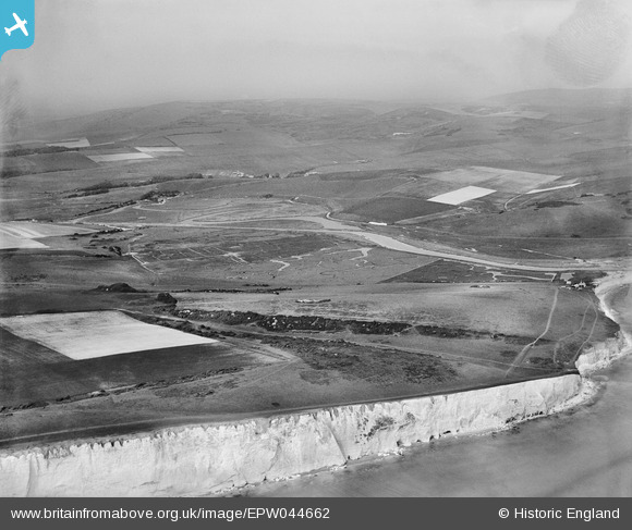
EPW044662 ENGLAND (1934). Hope Bottom and surrounding countryside, South Hill, from the south-west, 1934
© Copyright OpenStreetMap contributors and licensed by the OpenStreetMap Foundation. 2025. Cartography is licensed as CC BY-SA.
Nearby Images (2)
EPW044662

EPW044652

Details
| Title | [EPW044662] Hope Bottom and surrounding countryside, South Hill, from the south-west, 1934 |
| Reference | EPW044662 |
| Date | June-1934 |
| Link | |
| Place name | SOUTH HILL |
| Parish | SEAFORD |
| District | |
| Country | ENGLAND |
| Easting / Northing | 550856, 97573 |
| Longitude / Latitude | 0.13905370782107, 50.75755041072 |
| National Grid Reference | TV509976 |
Pins
Be the first to add a comment to this image!