
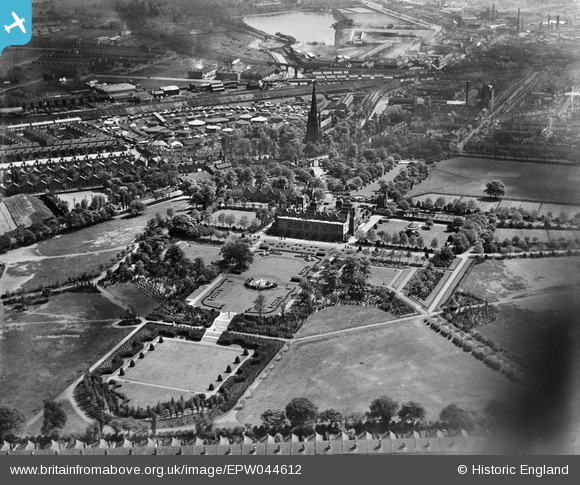
EPW044612 ENGLAND (1934). Aston Hall and Aston Park, Aston, 1934
© Copyright OpenStreetMap contributors and licensed by the OpenStreetMap Foundation. 2026. Cartography is licensed as CC BY-SA.
Nearby Images (9)
EPW044612

EPW044608

EPW044614

EPW044610

EPW044613

EPW044611

EPW044615

EPW044609

EPW044616

Details
| Title | [EPW044612] Aston Hall and Aston Park, Aston, 1934 |
| Reference | EPW044612 |
| Date | May-1934 |
| Link | |
| Place name | ASTON |
| Parish | |
| District | |
| Country | ENGLAND |
| Easting / Northing | 407923, 289855 |
| Longitude / Latitude | -1.8832570087648, 52.506167043713 |
| National Grid Reference | SP079899 |
Pins

Bedders |
Saturday 9th of January 2021 02:14:42 AM | |
|
areed |
Thursday 23rd of April 2020 10:48:40 PM | |

..AAAston Lad |
Friday 14th of June 2013 09:55:58 PM |