
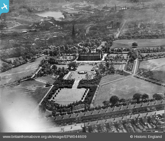
EPW044609 ENGLAND (1934). Aston Hall, Aston Park and surroundings, Aston, 1934. This image has been affected by flare.
© Copyright OpenStreetMap contributors and licensed by the OpenStreetMap Foundation. 2026. Cartography is licensed as CC BY-SA.
Nearby Images (9)
EPW044609

EPW044615

EPW044611

EPW044613

EPW044610

EPW044608

EPW044614

EPW044612

EPW044616

Details
| Title | [EPW044609] Aston Hall, Aston Park and surroundings, Aston, 1934. This image has been affected by flare. |
| Reference | EPW044609 |
| Date | May-1934 |
| Link | |
| Place name | ASTON |
| Parish | |
| District | |
| Country | ENGLAND |
| Easting / Northing | 407881, 289857 |
| Longitude / Latitude | -1.8838758171956, 52.506185634466 |
| National Grid Reference | SP079899 |
Pins
Be the first to add a comment to this image!