
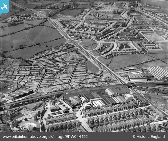
EPW044452 ENGLAND (1934). The Alvis Car and Engineering Works, allotment gardens off Holyhead Road and environs, Coventry, 1934
© Copyright OpenStreetMap contributors and licensed by the OpenStreetMap Foundation. 2026. Cartography is licensed as CC BY-SA.
Nearby Images (29)
EPW044452

EPW046377

EPW044451

EPW051454

EPW051461

EPW044457

EPW046375

EPW046376

EPW044453

EPW044454

EPW051456

EPW051459

EPW051460

EPW051462

EPW051467

EPW051455

EPW051464

EPW044455

EPW051463

EPW051457

EPW035780

EPW051466

EPW051465

EPW044456

EPW046374

EPW046379

EPW046373

EPW046378

EPW053106

Details
| Title | [EPW044452] The Alvis Car and Engineering Works, allotment gardens off Holyhead Road and environs, Coventry, 1934 |
| Reference | EPW044452 |
| Date | May-1934 |
| Link | |
| Place name | COVENTRY |
| Parish | |
| District | |
| Country | ENGLAND |
| Easting / Northing | 432163, 279467 |
| Longitude / Latitude | -1.527097959229, 52.411880028847 |
| National Grid Reference | SP322795 |
Pins

Darren |
Saturday 20th of April 2019 01:59:17 PM |