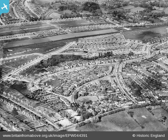
EPW044391 ENGLAND (1934). Housing estate to the south of the Southern Railway Dartford Loop Line centred upon Longlands Park Crescent, Sidcup, 1934
    © Copyright OpenStreetMap contributors and licensed by the OpenStreetMap Foundation. 2025. Cartography is licensed as CC BY-SA.
  
Nearby Images (5)
Details
| Title | [EPW044391] Housing estate to the south of the Southern Railway Dartford Loop Line centred upon Longlands Park Crescent, Sidcup, 1934 | 
| Reference | EPW044391 | 
| Date | May-1934 | 
| Link | |
| Place name | SIDCUP | 
| Parish | |
| District | |
| Country | ENGLAND | 
| Easting / Northing | 545246, 172503 | 
| Longitude / Latitude | 0.0897112029782, 51.432394896643 | 
| National Grid Reference | TQ452725 | 
Pins
Be the first to add a comment to this image!
 
             
  ![[EPW044391] Housing estate to the south of the Southern Railway Dartford Loop Line centred upon Longlands Park Crescent, Sidcup, 1934](http://britainfromabove.org.uk/sites/all/libraries/aerofilms-images/public/100x100/EPW/044/EPW044391.jpg) 
  
                                          ![[EPW038219] Construction of new housing around Old Farm Avenue and environs, Sidcup, from the south-west, 1932](http://britainfromabove.org.uk/sites/all/libraries/aerofilms-images/public/100x100/EPW/038/EPW038219.jpg) 
 ![[EPW044853] Housing under construction along Harland Avenue, Brooklands Avenue and environs, Sidcup, 1934](http://britainfromabove.org.uk/sites/all/libraries/aerofilms-images/public/100x100/EPW/044/EPW044853.jpg) 
 ![[EPW044390] Housing estate under construction between the Southern Railway Dartford Loop Line and Sidcup Road, Sidcup, 1934](http://britainfromabove.org.uk/sites/all/libraries/aerofilms-images/public/100x100/EPW/044/EPW044390.jpg) 
 ![[EPW044392] Housing estates to the north and south of the Southern Railway Dartford Loop Line, Sidcup, 1934](http://britainfromabove.org.uk/sites/all/libraries/aerofilms-images/public/100x100/EPW/044/EPW044392.jpg)