
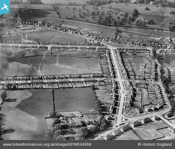
EPW044368 ENGLAND (1934). Harcourt Avenue, Rowley Avenue and environs, Sidcup, 1934
© Copyright OpenStreetMap contributors and licensed by the OpenStreetMap Foundation. 2026. Cartography is licensed as CC BY-SA.
Nearby Images (11)
EPW044368

EPW040876

EPW040887

EPW038439

EPW040878

EPW044369

EPW044367

EPW044364

EPW040882

EPW040879

EPW040881

Details
| Title | [EPW044368] Harcourt Avenue, Rowley Avenue and environs, Sidcup, 1934 |
| Reference | EPW044368 |
| Date | May-1934 |
| Link | |
| Place name | SIDCUP |
| Parish | |
| District | |
| Country | ENGLAND |
| Easting / Northing | 547158, 173902 |
| Longitude / Latitude | 0.11778141651829, 51.444473521767 |
| National Grid Reference | TQ472739 |
Pins

Gilarchaeology |
Tuesday 25th of June 2013 01:08:51 PM | |
|
Gilarchaeology |
Tuesday 25th of June 2013 01:08:04 PM | |
|
Gilarchaeology |
Tuesday 25th of June 2013 01:07:49 PM |