
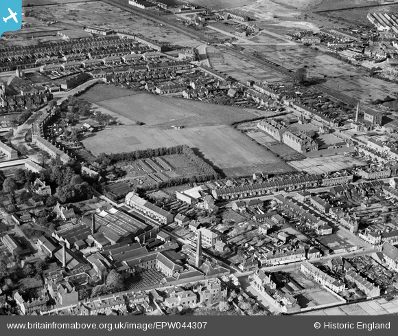
EPW044307 ENGLAND (1934). Alma Road School and surrounding residential area, Ponders End, 1934
© Copyright OpenStreetMap contributors and licensed by the OpenStreetMap Foundation. 2026. Cartography is licensed as CC BY-SA.
Nearby Images (33)
EPW044307

EPW044305

EPW044308

EAW005483

EAW005481

EAW048489

EPW044306

EAW005479

EAW005489

EAW048503

EAW005491

EAW048501

EAW005490

EAW005480

EAW048502

EAW048487

EAW005487

EAW005484

EAW048500

EAW048494

EAW048490

EAW005482

EAW005488

EAW048493

EAW005486

EAW048492

EAW048495

EAW048504

EAW048498

EAW048491

EAW048497

EAW048496

EPW044309

Details
| Title | [EPW044307] Alma Road School and surrounding residential area, Ponders End, 1934 |
| Reference | EPW044307 |
| Date | May-1934 |
| Link | |
| Place name | PONDERS END |
| Parish | |
| District | |
| Country | ENGLAND |
| Easting / Northing | 535866, 195801 |
| Longitude / Latitude | -0.036160606227553, 51.644105647356 |
| National Grid Reference | TQ359958 |
Pins
Be the first to add a comment to this image!