
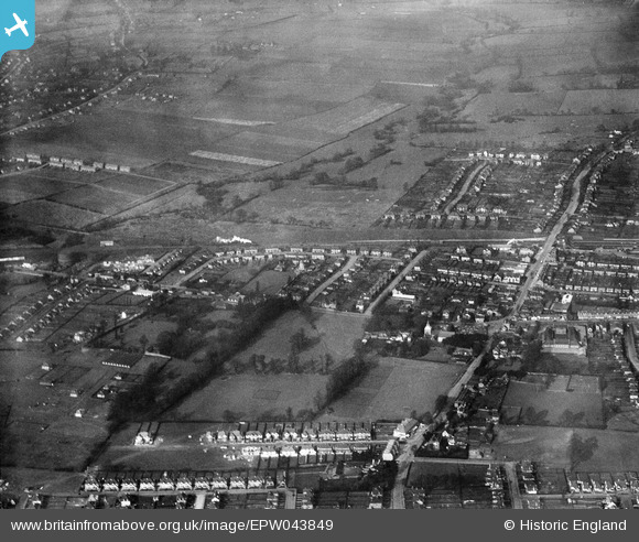
EPW043849 ENGLAND (1934). Upminster Park and environs, Upminster, 1934
© Copyright OpenStreetMap contributors and licensed by the OpenStreetMap Foundation. 2026. Cartography is licensed as CC BY-SA.
Nearby Images (11)
EPW043849

EPW043851

EPW043924

EAW043658

EPW043918

EAW043659

EAW043657

EPW043844

EPW043843

EPW043845

EPW043921

Details
| Title | [EPW043849] Upminster Park and environs, Upminster, 1934 |
| Reference | EPW043849 |
| Date | March-1934 |
| Link | |
| Place name | UPMINSTER |
| Parish | |
| District | |
| Country | ENGLAND |
| Easting / Northing | 555757, 186772 |
| Longitude / Latitude | 0.24711530900506, 51.557818444337 |
| National Grid Reference | TQ558868 |
Pins

Cliffjb |
Wednesday 4th of October 2017 01:53:25 PM | |

hillman34 |
Monday 10th of June 2013 07:23:34 PM | |
|
hillman34 |
Sunday 9th of June 2013 10:44:49 PM | |
|
hillman34 |
Sunday 9th of June 2013 10:42:55 PM | |
|
hillman34 |
Sunday 9th of June 2013 10:40:44 PM | |
|
hillman34 |
Sunday 9th of June 2013 10:39:06 PM | |
|
hillman34 |
Sunday 9th of June 2013 10:35:47 PM | |
|
hillman34 |
Sunday 9th of June 2013 10:33:50 PM |