
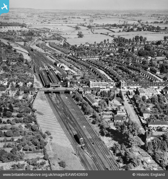
EAW043659 ENGLAND (1952). Upminster Station, Upminster, from the west, 1952
© Copyright OpenStreetMap contributors and licensed by the OpenStreetMap Foundation. 2026. Cartography is licensed as CC BY-SA.
Nearby Images (11)
EAW043659

EPW043844

EPW043918

EPW043845

EPW043843

EPW043853

EPW043846

EPW043851

EPW043849

EPW043924

EAW043658

Details
| Title | [EAW043659] Upminster Station, Upminster, from the west, 1952 |
| Reference | EAW043659 |
| Date | 4-June-1952 |
| Link | |
| Place name | UPMINSTER |
| Parish | |
| District | |
| Country | ENGLAND |
| Easting / Northing | 555972, 186846 |
| Longitude / Latitude | 0.25024738411762, 51.558423954299 |
| National Grid Reference | TQ560868 |
Pins

Class51 |
Thursday 12th of January 2017 12:29:50 PM | |
|
Class51 |
Thursday 12th of January 2017 12:26:58 PM | |
|
Class51 |
Thursday 12th of January 2017 12:25:28 PM | |
|
Class51 |
Thursday 12th of January 2017 12:24:41 PM | |
|
GeoffR |
Thursday 15th of January 2015 04:50:03 PM | |
|
GeoffR |
Thursday 15th of January 2015 04:49:15 PM | |
|
GeoffR |
Thursday 15th of January 2015 04:47:55 PM | |
|
GeoffR |
Thursday 15th of January 2015 04:46:01 PM | |
|
GeoffR |
Thursday 15th of January 2015 04:44:56 PM | |
|
GeoffR |
Thursday 15th of January 2015 04:44:16 PM |