
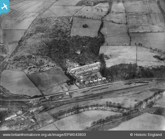
EPW043803 ENGLAND (1934). Lands Wood, Noel Terrace and the Garesfield and Chopwell Railway, Winlaton Mill, 1934
© Copyright OpenStreetMap contributors and licensed by the OpenStreetMap Foundation. 2025. Cartography is licensed as CC BY-SA.
Nearby Images (3)
EPW043803

EPW043799

EPW043801

Details
| Title | [EPW043803] Lands Wood, Noel Terrace and the Garesfield and Chopwell Railway, Winlaton Mill, 1934 |
| Reference | EPW043803 |
| Date | February-1934 |
| Link | |
| Place name | WINLATON MILL |
| Parish | |
| District | |
| Country | ENGLAND |
| Easting / Northing | 418504, 561090 |
| Longitude / Latitude | -1.7111062654559, 54.944047098498 |
| National Grid Reference | NZ185611 |
Pins

totoro |
Tuesday 8th of March 2016 09:59:22 PM | |
|
totoro |
Tuesday 8th of March 2016 09:37:16 PM |