
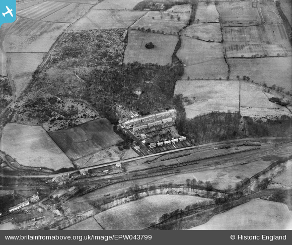
EPW043799 ENGLAND (1934). Lands Wood, Noel Terrace and the Garesfield and Chopwell Railway, Winlaton Mill, 1934
© Copyright OpenStreetMap contributors and licensed by the OpenStreetMap Foundation. 2025. Cartography is licensed as CC BY-SA.
Nearby Images (3)
EPW043799

EPW043803

EPW043801

Details
| Title | [EPW043799] Lands Wood, Noel Terrace and the Garesfield and Chopwell Railway, Winlaton Mill, 1934 |
| Reference | EPW043799 |
| Date | February-1934 |
| Link | |
| Place name | WINLATON MILL |
| Parish | |
| District | |
| Country | ENGLAND |
| Easting / Northing | 418507, 561094 |
| Longitude / Latitude | -1.7110591708132, 54.944082935956 |
| National Grid Reference | NZ185611 |
Pins
User Comment Contributions
Garesfield and Chopwell Railway 1896 – 1961 Now "Old Colliery Railway Footpath". A short stretch of track on the footpath holds a couple of coal wagons. Initial use was t carry bricks to build the colliery, from High Spen to Chopwell. Subsequently used to move coal - 3000 tons per day. The line joined the "mainline" at High Spen where there had been a colliery since around 1800. The coal was taken to the River Tyne (Derwenthaugh). The mines at Chopwell and High Spen closed in 1960 and the line after passing from LNER to BR was closed. |

totoro |
Tuesday 8th of March 2016 09:35:25 PM |