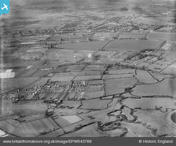
EPW043788 ENGLAND (1934). Field Common and environs, Walton-on-Thames, from the south-east, 1934

© Copyright OpenStreetMap contributors and licensed by the OpenStreetMap Foundation. 2025. Cartography is licensed as CC BY-SA.

Nearby Images (2)

EPW043788
  0° 0m
EPW043790
  113° 183m

Details

Title [EPW043788] Field Common and environs, Walton-on-Thames, from the south-east, 1934
Reference EPW043788
Date February-1934
Link
Place name WALTON-ON-THAMES
Parish
District
Country ENGLAND
Easting / Northing 512902, 166680
Longitude / Latitude -0.37725944327615, 51.387422178056
National Grid Reference TQ129667

Pins

I think this could be the Kempton Park waterworks reciprocating pumping station - first of it's kind in the country, maybe the World - but can only see one chimney, am sure they had two, twin-like, by the 1950's. Hopefully someone in the know about this waterworks can confirm..

nigs
Friday 16th of January 2015 03:18:41 PM
This could be the Walton Road extension, which now leads into Walton and joins Terrace Road at App's Court junction... trouble is I can't distinguish any reservoir banking in the photograph, may just not be clear enough, though. .

nigs
Monday 29th of December 2014 07:52:44 PM
Fieldcommon Farm, later known as Harold Poopart's Farm

nigs
Monday 29th of December 2014 07:47:10 PM
App's Court Tavern

nigs
Monday 29th of December 2014 07:44:11 PM
Molesey Road, leading to Hersham, which was re-routed in a more straight line to make way for the new Queen Elizabeth reservoir which was built in the late 1950's

nigs
Monday 29th of December 2014 07:32:44 PM
Walton Road, West Molesey.

nigs
Monday 29th of December 2014 07:28:36 PM
Sunbury church - the bells sounded lovely on Molesey side of river every Sunday in the 1950's

nigs
Monday 29th of December 2014 07:26:09 PM
This is the path that we called Pig's Alley as children in the 1950's, as it went past pig-farm enclosures then on down to the Thames at Sunbury, emerging near the locks. The farm is still there, operating without pigs as far as I know.

nigs
Monday 29th of December 2014 07:20:12 PM
River Thames near Sunbury Locks

nigs
Monday 29th of December 2014 07:14:25 PM
I think this is Western Avenue, West Molesey.

nigs
Monday 29th of December 2014 07:12:10 PM
Hurst Road, West Molesey. Leads to Walton on Thames by continuing as Terrace Road further on at junction of App's Court Tavern.

nigs
Monday 29th of December 2014 07:10:22 PM
Waterworks on the Hurst Road, West Molesey, with it's distinctive red and blue brick chimney. The works are still there, but alas, that beautiful chimney, which I loved as a child, and should have been preserved as a valuable balance to architecture of overall building, was removed in the 1970's when pumping converted from coal to oil (or electricity).

nigs
Monday 29th of December 2014 07:06:55 PM