
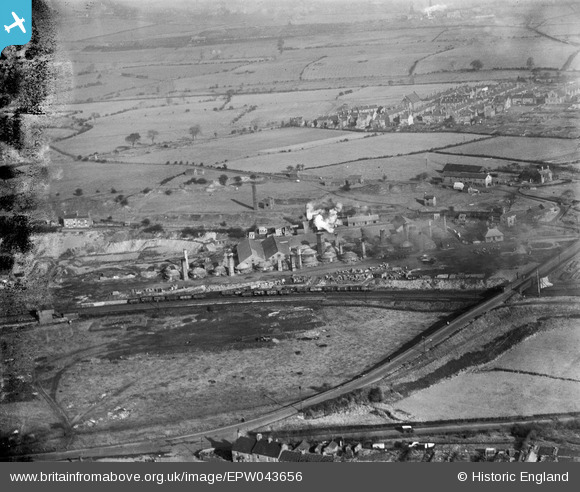
EPW043656 ENGLAND (1933). Knutton Tileries, Newcastle-under-Lyme, from the south-west, 1933
© Copyright OpenStreetMap contributors and licensed by the OpenStreetMap Foundation. 2026. Cartography is licensed as CC BY-SA.
Nearby Images (12)
EPW043656

EPW038477

EPW027808

EPW038481

EPW043652

EPW038480

EPW038476

EPW038478

EPW027807

EPW043655

EPW043654

EPW038479

Details
| Title | [EPW043656] Knutton Tileries, Newcastle-under-Lyme, from the south-west, 1933 |
| Reference | EPW043656 |
| Date | November-1933 |
| Link | |
| Place name | NEWCASTLE-UNDER-LYME |
| Parish | SILVERDALE |
| District | |
| Country | ENGLAND |
| Easting / Northing | 382975, 346537 |
| Longitude / Latitude | -2.2538024727333, 53.01555790239 |
| National Grid Reference | SJ830465 |
Pins

bescotbeast |
Friday 28th of February 2014 07:14:00 PM | |
|
bescotbeast |
Friday 28th of February 2014 07:12:35 PM |
User Comment Contributions

Ketley Sidings signal box, controlled access to the Pool Dam branch |
bescotbeast |
Friday 28th of February 2014 07:14:37 PM |