
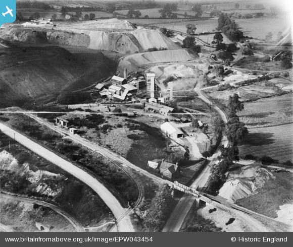
EPW043454 ENGLAND (1933). The Hartshill Quarries, Hartshill, 1933
© Copyright OpenStreetMap contributors and licensed by the OpenStreetMap Foundation. 2025. Cartography is licensed as CC BY-SA.
Nearby Images (11)
EPW043454

EPW043449

EPW043450

EPW043451

EPW042882

EPW043455

EPW043453

EPW042886

EPW042885

EPW043452

EPW042884

Details
| Title | [EPW043454] The Hartshill Quarries, Hartshill, 1933 |
| Reference | EPW043454 |
| Date | October-1933 |
| Link | |
| Place name | HARTSHILL |
| Parish | HARTSHILL |
| District | |
| Country | ENGLAND |
| Easting / Northing | 433442, 294289 |
| Longitude / Latitude | -1.5068053623297, 52.545063146694 |
| National Grid Reference | SP334943 |
Pins
Be the first to add a comment to this image!