
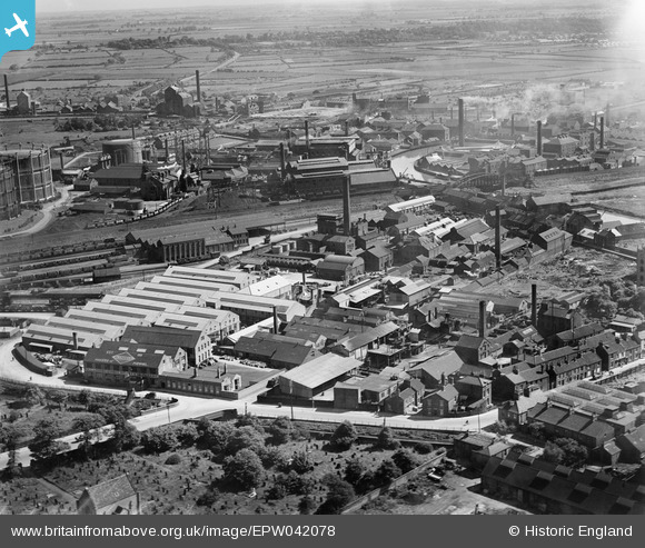
EPW042078 ENGLAND (1933). Sculcoates Lane, the Greenland Paint & Colour Works and adjacent factories, Sculcoates, 1933
© Copyright OpenStreetMap contributors and licensed by the OpenStreetMap Foundation. 2026. Cartography is licensed as CC BY-SA.
Nearby Images (15)
EPW042078

EPW042075

EPW036532

EPW042072

EPW042074

EPW042077

EPW036525

EPW036510

EPW042076

EPW042073

EPW036522

EPW036508

EAW030288

EPW010837

EPW006338

Details
| Title | [EPW042078] Sculcoates Lane, the Greenland Paint & Colour Works and adjacent factories, Sculcoates, 1933 |
| Reference | EPW042078 |
| Date | June-1933 |
| Link | |
| Place name | SCULCOATES |
| Parish | |
| District | |
| Country | ENGLAND |
| Easting / Northing | 509718, 430867 |
| Longitude / Latitude | -0.33541563404042, 53.762366520984 |
| National Grid Reference | TA097309 |
Pins

Giddo |
Monday 5th of September 2016 06:23:43 PM | |
|
Giddo |
Monday 5th of September 2016 06:20:54 PM | |
|
Giddo |
Monday 5th of September 2016 06:19:08 PM | |

Dylan Moore |
Monday 6th of May 2013 08:28:30 PM |