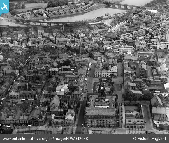
EPW042038 ENGLAND (1933). The Town Hall, Great John Street and the city centre, Lancaster, 1933
© Copyright OpenStreetMap contributors and licensed by the OpenStreetMap Foundation. 2026. Cartography is licensed as CC BY-SA.
Nearby Images (5)
EPW042038

EPW029176

EPW029183

EPW002087

EPW002081

Details
| Title | [EPW042038] The Town Hall, Great John Street and the city centre, Lancaster, 1933 |
| Reference | EPW042038 |
| Date | June-1933 |
| Link | |
| Place name | LANCASTER |
| Parish | |
| District | |
| Country | ENGLAND |
| Easting / Northing | 347837, 461691 |
| Longitude / Latitude | -2.7967882246939, 54.0483561808 |
| National Grid Reference | SD478617 |
Pins

Class31 |
Sunday 15th of May 2016 08:33:43 PM | |
|
Class31 |
Sunday 15th of May 2016 08:32:42 PM | |

sirdouglas |
Sunday 15th of May 2016 12:21:16 PM | |
|
sirdouglas |
Sunday 15th of May 2016 12:20:53 PM | |
|
sirdouglas |
Sunday 15th of May 2016 12:20:34 PM |