
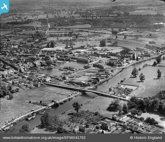
EPW041762 ENGLAND (1933). The Dock Basins and environs, Stourport-on-Severn, from the south-west, 1933
© Copyright OpenStreetMap contributors and licensed by the OpenStreetMap Foundation. 2026. Cartography is licensed as CC BY-SA.
Nearby Images (2)
EPW041762

EPW015076

Details
| Title | [EPW041762] The Dock Basins and environs, Stourport-on-Severn, from the south-west, 1933 |
| Reference | EPW041762 |
| Date | June-1933 |
| Link | |
| Place name | STOURPORT-ON-SEVERN |
| Parish | STOURPORT-ON-SEVERN |
| District | |
| Country | ENGLAND |
| Easting / Northing | 380790, 271055 |
| Longitude / Latitude | -2.2819715372579, 52.336855564554 |
| National Grid Reference | SO808711 |
Pins
Be the first to add a comment to this image!