
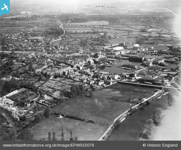
EPW015076 ENGLAND (1926). The town, Stourport-on-Severn, 1926. This image has been produced from a copy-negative affected by flare.
© Copyright OpenStreetMap contributors and licensed by the OpenStreetMap Foundation. 2026. Cartography is licensed as CC BY-SA.
Nearby Images (4)
EPW015076

EPW015079

EPW015082

EPW041762

Details
| Title | [EPW015076] The town, Stourport-on-Severn, 1926. This image has been produced from a copy-negative affected by flare. |
| Reference | EPW015076 |
| Date | 12-April-1926 |
| Link | |
| Place name | STOURPORT-ON-SEVERN |
| Parish | STOURPORT-ON-SEVERN |
| District | |
| Country | ENGLAND |
| Easting / Northing | 380960, 271231 |
| Longitude / Latitude | -2.2794862220308, 52.338443929649 |
| National Grid Reference | SO810712 |
Pins
Be the first to add a comment to this image!