
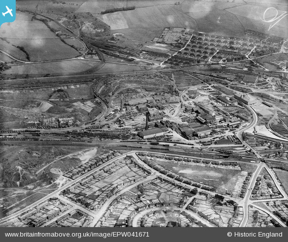
EPW041671 ENGLAND (1933). The Staveley Iron Works and environs, Staveley, 1933
© Copyright OpenStreetMap contributors and licensed by the OpenStreetMap Foundation. 2026. Cartography is licensed as CC BY-SA.
Nearby Images (17)
EPW041671

EPW057352

EAW003057

EAW003072

EPW041666

EPW041669

EAW044348

EPW041665

EPW041668

EPW041667

EPW057342

EPW041672

EPW057341

EPW057335

EAW003058

EPW041670

EAW003059

Details
| Title | [EPW041671] The Staveley Iron Works and environs, Staveley, 1933 |
| Reference | EPW041671 |
| Date | June-1933 |
| Link | |
| Place name | STAVELEY |
| Parish | STAVELEY |
| District | |
| Country | ENGLAND |
| Easting / Northing | 441317, 374883 |
| Longitude / Latitude | -1.3804214082733, 53.269049688704 |
| National Grid Reference | SK413749 |
Pins

Don Rawding |
Friday 25th of December 2015 05:54:55 AM |