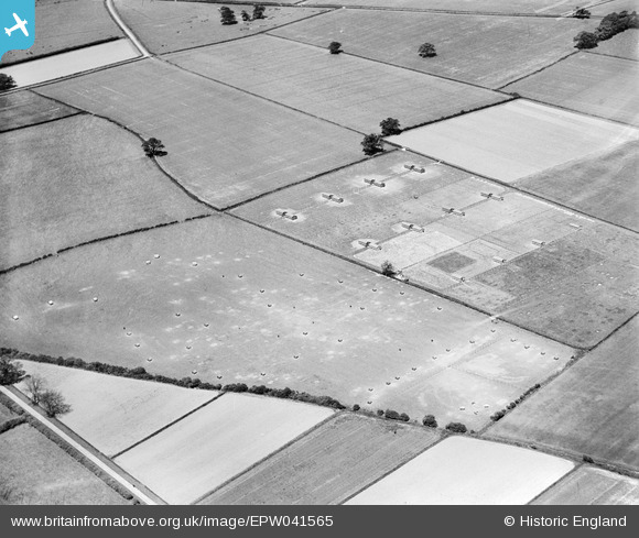
EPW041565 ENGLAND (1933). Agricultural land west of the village, Sutton-on-Trent, 1933
© Copyright OpenStreetMap contributors and licensed by the OpenStreetMap Foundation. 2026. Cartography is licensed as CC BY-SA.
Nearby Images (5)
Details
| Title | [EPW041565] Agricultural land west of the village, Sutton-on-Trent, 1933 |
| Reference | EPW041565 |
| Date | June-1933 |
| Link | |
| Place name | SUTTON-ON-TRENT |
| Parish | SUTTON-ON-TRENT |
| District | |
| Country | ENGLAND |
| Easting / Northing | 478391, 366132 |
| Longitude / Latitude | -0.82671964745477, 53.186211868092 |
| National Grid Reference | SK784661 |
Pins
Be the first to add a comment to this image!


![[EPW041565] Agricultural land west of the village, Sutton-on-Trent, 1933](http://britainfromabove.org.uk/sites/all/libraries/aerofilms-images/public/100x100/EPW/041/EPW041565.jpg)
![[EPW041563] Agricultural land west of the village, Sutton-on-Trent, 1933](http://britainfromabove.org.uk/sites/all/libraries/aerofilms-images/public/100x100/EPW/041/EPW041563.jpg)
![[EPW041564] Agricultural land west of the village, Sutton-on-Trent, 1933](http://britainfromabove.org.uk/sites/all/libraries/aerofilms-images/public/100x100/EPW/041/EPW041564.jpg)
![[EPW041557] The E.C. Walton & Co Muskham Works and surrounding agricultural land, Sutton-on-Trent, 1933](http://britainfromabove.org.uk/sites/all/libraries/aerofilms-images/public/100x100/EPW/041/EPW041557.jpg)
![[EPW041555] The E.C. Walton & Co Muskham Works and surrounding agricultural land, Sutton-on-Trent, 1933](http://britainfromabove.org.uk/sites/all/libraries/aerofilms-images/public/100x100/EPW/041/EPW041555.jpg)