
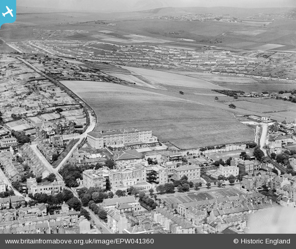
EPW041360 ENGLAND (1933). The Royal Sussex County Hospital and Whitehawk Hill, Brighton, from the south-west, 1933
© Copyright OpenStreetMap contributors and licensed by the OpenStreetMap Foundation. 2026. Cartography is licensed as CC BY-SA.
Nearby Images (9)
EPW041360

EPW041357

EPW041356

EPW041354

EPW041355

EPW041358

EPW041359

EPW054035

EPW016877

Details
| Title | [EPW041360] The Royal Sussex County Hospital and Whitehawk Hill, Brighton, from the south-west, 1933 |
| Reference | EPW041360 |
| Date | May-1933 |
| Link | |
| Place name | BRIGHTON |
| Parish | |
| District | |
| Country | ENGLAND |
| Easting / Northing | 532663, 103888 |
| Longitude / Latitude | -0.1164737609939, 50.81875939684 |
| National Grid Reference | TQ327039 |
Pins

Alan McFaden |
Monday 29th of July 2013 06:33:50 PM | |
First World War Military Hospital |
Lynda Tubbs |
Wednesday 22nd of January 2014 11:32:47 AM |
