
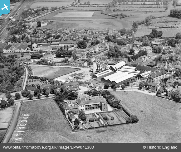
EPW041303 ENGLAND (1933). Chivers and Sons Canning Factory and environs, Huntingdon, 1933
© Copyright OpenStreetMap contributors and licensed by the OpenStreetMap Foundation. 2026. Cartography is licensed as CC BY-SA.
Nearby Images (11)
EPW041303

EPW041304

EPW041298

EPW041300

EPW041301

EPW041302

EPW041299

EPW041297

EPW009845

EPW041331

EPW009842

Details
| Title | [EPW041303] Chivers and Sons Canning Factory and environs, Huntingdon, 1933 |
| Reference | EPW041303 |
| Date | May-1933 |
| Link | |
| Place name | HUNTINGDON |
| Parish | HUNTINGDON |
| District | |
| Country | ENGLAND |
| Easting / Northing | 523512, 271870 |
| Longitude / Latitude | -0.18722564654521, 52.330611969689 |
| National Grid Reference | TL235719 |
Pins

Sapley man |
Thursday 14th of January 2021 12:36:08 PM | |
|
John Wass |
Monday 9th of February 2015 02:35:19 PM | |
|
John Wass |
Monday 9th of February 2015 02:33:15 PM | |

Class31 |
Wednesday 10th of September 2014 08:50:23 AM | |
|
Class31 |
Wednesday 10th of September 2014 08:49:53 AM | |
|
Class31 |
Wednesday 10th of September 2014 08:49:17 AM |


