
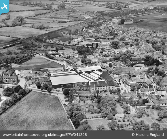
EPW041298 ENGLAND (1933). Chivers and Sons Canning Factory, Huntingdon, 1933
© Copyright OpenStreetMap contributors and licensed by the OpenStreetMap Foundation. 2026. Cartography is licensed as CC BY-SA.
Nearby Images (11)
EPW041298

EPW041303

EPW041304

EPW041301

EPW041300

EPW041302

EPW041299

EPW041297

EPW009845

EPW041331

EPW009842

Details
| Title | [EPW041298] Chivers and Sons Canning Factory, Huntingdon, 1933 |
| Reference | EPW041298 |
| Date | May-1933 |
| Link | |
| Place name | HUNTINGDON |
| Parish | HUNTINGDON |
| District | |
| Country | ENGLAND |
| Easting / Northing | 523520, 271873 |
| Longitude / Latitude | -0.18710719250206, 52.330637128728 |
| National Grid Reference | TL235719 |


