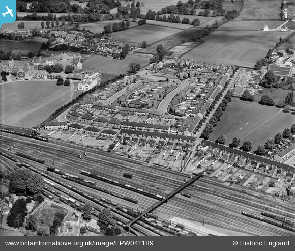
EPW041189 ENGLAND (1933). Addison Grove and environs, Rowbarton, 1933
© Copyright OpenStreetMap contributors and licensed by the OpenStreetMap Foundation. 2026. Cartography is licensed as CC BY-SA.
Nearby Images (7)
Details
| Title | [EPW041189] Addison Grove and environs, Rowbarton, 1933 |
| Reference | EPW041189 |
| Date | May-1933 |
| Link | |
| Place name | ROWBARTON |
| Parish | |
| District | |
| Country | ENGLAND |
| Easting / Northing | 322135, 125703 |
| Longitude / Latitude | -3.1103833673447, 51.0248785502 |
| National Grid Reference | ST221257 |


![[EPW041189] Addison Grove and environs, Rowbarton, 1933](http://britainfromabove.org.uk/sites/all/libraries/aerofilms-images/public/100x100/EPW/041/EPW041189.jpg)
![[EPW037671] Taunton School and environs, Taunton, from the south, 1932. This image has been produced from a print.](http://britainfromabove.org.uk/sites/all/libraries/aerofilms-images/public/100x100/EPW/037/EPW037671.jpg)
![[EPW037672] Taunton School, Taunton, 1932. This image has been produced from a copy-negative.](http://britainfromabove.org.uk/sites/all/libraries/aerofilms-images/public/100x100/EPW/037/EPW037672.jpg)
![[EPW061342] The Avimo Ltd Works, Greenway Recreation Ground and environs, Taunton, 1939](http://britainfromabove.org.uk/sites/all/libraries/aerofilms-images/public/100x100/EPW/061/EPW061342.jpg)
![[EPW061341] The Avimo Ltd Works, Maxwell Street and environs, Taunton, 1939](http://britainfromabove.org.uk/sites/all/libraries/aerofilms-images/public/100x100/EPW/061/EPW061341.jpg)
![[EPW061348] The Avimo Ltd Work and environs, Taunton, 1939](http://britainfromabove.org.uk/sites/all/libraries/aerofilms-images/public/100x100/EPW/061/EPW061348.jpg)
![[EPW061344] The Avimo Ltd Works, Cyril Street and environs, Taunton, 1939](http://britainfromabove.org.uk/sites/all/libraries/aerofilms-images/public/100x100/EPW/061/EPW061344.jpg)
