
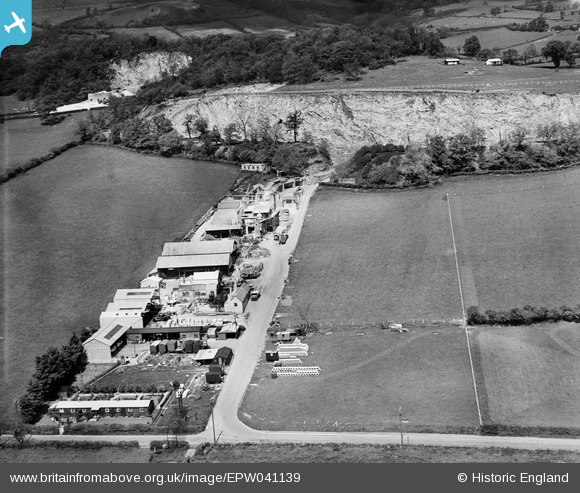
EPW041139 ENGLAND (1933). Underwood Quarry, Wookey Hole, 1933
© Copyright OpenStreetMap contributors and licensed by the OpenStreetMap Foundation. 2026. Cartography is licensed as CC BY-SA.
Nearby Images (3)
EPW041139

EPW041138

EPR000101

Details
| Title | [EPW041139] Underwood Quarry, Wookey Hole, 1933 |
| Reference | EPW041139 |
| Date | May-1933 |
| Link | |
| Place name | WOOKEY HOLE |
| Parish | ST. CUTHBERT OUT |
| District | |
| Country | ENGLAND |
| Easting / Northing | 353824, 146703 |
| Longitude / Latitude | -2.6612201169328, 51.217140877926 |
| National Grid Reference | ST538467 |
Pins

Benny boy |
Sunday 21st of February 2016 04:20:27 PM | |
|
Benny boy |
Sunday 21st of February 2016 04:19:41 PM | |
|
Benny boy |
Sunday 21st of February 2016 04:18:38 PM | |
|
Benny boy |
Sunday 21st of February 2016 04:17:14 PM |