
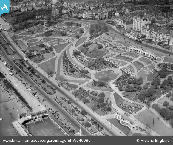
EPW040980 ENGLAND (1933). The Cifffs, Southend-on-Sea, 1933
© Copyright OpenStreetMap contributors and licensed by the OpenStreetMap Foundation. 2026. Cartography is licensed as CC BY-SA.
Nearby Images (27)
EPW040980

EPW040968

EAW053091

EAW002197

EPW036994

EAW002196

EPW036713

EPW032905

EAW002195

EPW024862

EPW036740

EPW036991

EPW036728

EPW024861

EPW024866

EAW053090

EPW039869

EPW054670

EPW000449

EPW054676

EPW040984

EPW058504

EPW036992

EPW036739

EPW000447

EPW036993

EPW000562

Details
| Title | [EPW040980] The Cifffs, Southend-on-Sea, 1933 |
| Reference | EPW040980 |
| Date | April-1933 |
| Link | |
| Place name | SOUTHEND-ON-SEA |
| Parish | |
| District | |
| Country | ENGLAND |
| Easting / Northing | 587417, 185151 |
| Longitude / Latitude | 0.70251179546969, 51.533628179082 |
| National Grid Reference | TQ874852 |
Pins
Be the first to add a comment to this image!