
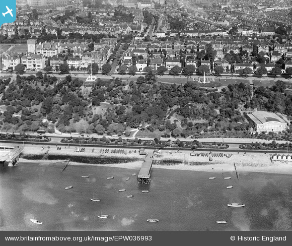
EPW036993 ENGLAND (1931). The Cliffs and environs, Clifftown, from the south, 1931
© Copyright OpenStreetMap contributors and licensed by the OpenStreetMap Foundation. 2026. Cartography is licensed as CC BY-SA.
Nearby Images (23)
EPW036993

EPW040984

EPW054670

EPW024879

EPW036712

EPW036739

EPW000564

EPW037017

EPW036740

EAW053090

EPW024862

EAW002195

EAW002196

EPW036734

EPW036994

EAW002197

EPW036998

EPW040968

EPW040980

EPW032905

EPW040986

EPW024868

EAW053091

Details
| Title | [EPW036993] The Cliffs and environs, Clifftown, from the south, 1931 |
| Reference | EPW036993 |
| Date | October-1931 |
| Link | |
| Place name | CLIFFTOWN |
| Parish | |
| District | |
| Country | ENGLAND |
| Easting / Northing | 587663, 185036 |
| Longitude / Latitude | 0.70599351514708, 51.532513480797 |
| National Grid Reference | TQ877850 |
Pins
Be the first to add a comment to this image!