
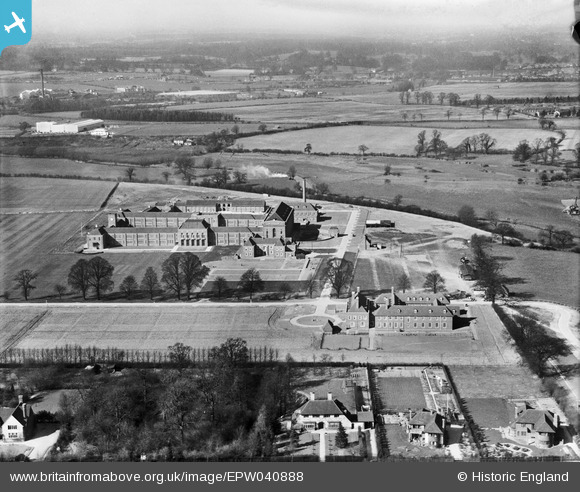
EPW040888 ENGLAND (1933). The Merchant Taylors' School, Moor Park, 1933
© Copyright OpenStreetMap contributors and licensed by the OpenStreetMap Foundation. 2026. Cartography is licensed as CC BY-SA.
Nearby Images (15)
EPW040888

EPW040895

EPW040899

EPW040889

EPW040892

EPW040890

EPW040891

EPR000496

EPW040893

EPR000494

EPR000495

EPW040896

EPW031471

EPW031285

EPW031466

Details
| Title | [EPW040888] The Merchant Taylors' School, Moor Park, 1933 |
| Reference | EPW040888 |
| Date | March-1933 |
| Link | |
| Place name | MOOR PARK |
| Parish | |
| District | |
| Country | ENGLAND |
| Easting / Northing | 509220, 194051 |
| Longitude / Latitude | -0.42167784585565, 51.634183377799 |
| National Grid Reference | TQ092941 |
Pins
Be the first to add a comment to this image!