
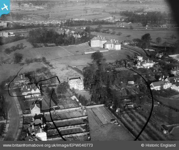
EPW040773 ENGLAND (1932). Hillcrest Road, Hanger Hill Park and Greystoke Court, Ealing, 1932. This image has been produced from a damaged negative.
© Copyright OpenStreetMap contributors and licensed by the OpenStreetMap Foundation. 2026. Cartography is licensed as CC BY-SA.
Nearby Images (11)
EPW040773

EPW040777

EPW026000

EPW025993

EPW025999

EPW025995

EPW040776

EPW040774

EPW025989

EPW025998

EPW025994

Details
| Title | [EPW040773] Hillcrest Road, Hanger Hill Park and Greystoke Court, Ealing, 1932. This image has been produced from a damaged negative. |
| Reference | EPW040773 |
| Date | December-1932 |
| Link | |
| Place name | EALING |
| Parish | |
| District | |
| Country | ENGLAND |
| Easting / Northing | 518444, 182023 |
| Longitude / Latitude | -0.29250212177847, 51.524204311227 |
| National Grid Reference | TQ184820 |
Pins

Class31 |
Monday 24th of March 2014 11:42:59 AM |