
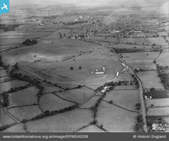
EPW040208 ENGLAND (1932). Carlisle Racecourse, Carlisle, 1932
© Copyright OpenStreetMap contributors and licensed by the OpenStreetMap Foundation. 2025. Cartography is licensed as CC BY-SA.
Nearby Images (5)
EPW040208

EAW016898

EPW040209

EAW016897

EAW016896

Details
| Title | [EPW040208] Carlisle Racecourse, Carlisle, 1932 |
| Reference | EPW040208 |
| Date | 7-September-1932 |
| Link | |
| Place name | CARLISLE |
| Parish | ST. CUTHBERT WITHOUT |
| District | |
| Country | ENGLAND |
| Easting / Northing | 340323, 551998 |
| Longitude / Latitude | -2.929760932502, 54.859118500469 |
| National Grid Reference | NY403520 |
Pins
Be the first to add a comment to this image!