
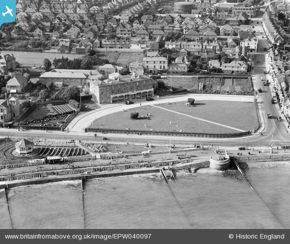
EPW040097 ENGLAND (1932). The Royal Norfolk Hotel, bandstand and environs, Bognor Regis, 1932
© Copyright OpenStreetMap contributors and licensed by the OpenStreetMap Foundation. 2026. Cartography is licensed as CC BY-SA.
Nearby Images (13)
EPW040097

EPW016854

EPW040095

EPW040096

EPW016907

EAW022236

EAW046802

EPW040107

EAW022233

EPW000760

EPW040104

EPW000721

EAW046504

Details
| Title | [EPW040097] The Royal Norfolk Hotel, bandstand and environs, Bognor Regis, 1932 |
| Reference | EPW040097 |
| Date | August-1932 |
| Link | |
| Place name | BOGNOR REGIS |
| Parish | BOGNOR REGIS |
| District | |
| Country | ENGLAND |
| Easting / Northing | 493152, 98785 |
| Longitude / Latitude | -0.67854563502624, 50.780583851705 |
| National Grid Reference | SZ932988 |
Pins

Starman |
Thursday 4th of January 2024 08:25:34 PM |