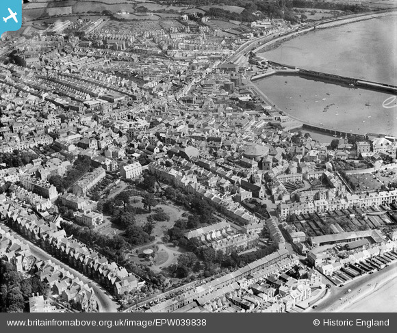
EPW039838 ENGLAND (1932). Morrab Gardens, the town centre and the Harbour, Penzance, 1932
© Copyright OpenStreetMap contributors and licensed by the OpenStreetMap Foundation. 2026. Cartography is licensed as CC BY-SA.
Nearby Images (5)
Details
| Title | [EPW039838] Morrab Gardens, the town centre and the Harbour, Penzance, 1932 |
| Reference | EPW039838 |
| Date | August-1932 |
| Link | |
| Place name | PENZANCE |
| Parish | PENZANCE |
| District | |
| Country | ENGLAND |
| Easting / Northing | 147327, 30114 |
| Longitude / Latitude | -5.5349407469606, 50.116607565271 |
| National Grid Reference | SW473301 |
Pins

Allan |
Thursday 24th of July 2025 10:04:56 PM | |

Weenieb |
Friday 4th of July 2014 03:22:51 PM | |

Weenieb |
Friday 4th of July 2014 03:21:40 PM | |

Weenieb |
Friday 4th of July 2014 03:20:23 PM | |

dave43 |
Sunday 9th of March 2014 09:07:32 PM | |

Bev |
Tuesday 20th of August 2013 11:21:53 PM |


![[EPW039838] Morrab Gardens, the town centre and the Harbour, Penzance, 1932](http://britainfromabove.org.uk/sites/all/libraries/aerofilms-images/public/100x100/EPW/039/EPW039838.jpg)
![[EPW039839] The town centre and the Harbour, Penzance, 1932](http://britainfromabove.org.uk/sites/all/libraries/aerofilms-images/public/100x100/EPW/039/EPW039839.jpg)
![[EPW021755] Morrab Gardens and the town, Penzance, 1928](http://britainfromabove.org.uk/sites/all/libraries/aerofilms-images/public/100x100/EPW/021/EPW021755.jpg)
![[EPW021759] Morrab Gardens and the town, Penzance, 1928](http://britainfromabove.org.uk/sites/all/libraries/aerofilms-images/public/100x100/EPW/021/EPW021759.jpg)
![[EAW280180] Town and harbour, Penzance, 1974](http://britainfromabove.org.uk/sites/all/libraries/aerofilms-images/public/100x100/EAW/280/EAW280180.jpg)