
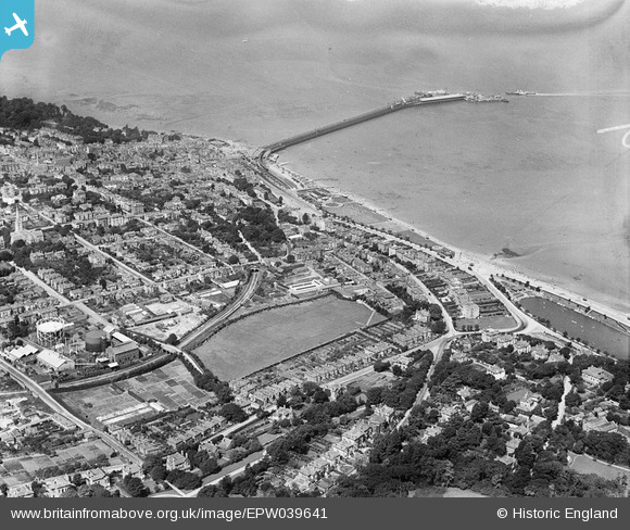
EPW039641 ENGLAND (1932). The town centre and the pier, Ryde, from the south-east, 1932
© Copyright OpenStreetMap contributors and licensed by the OpenStreetMap Foundation. 2026. Cartography is licensed as CC BY-SA.
Nearby Images (3)
EPW039641

EPW043019

EAW022221

Details
| Title | [EPW039641] The town centre and the pier, Ryde, from the south-east, 1932 |
| Reference | EPW039641 |
| Date | 12-August-1932 |
| Link | |
| Place name | RYDE |
| Parish | RYDE |
| District | |
| Country | ENGLAND |
| Easting / Northing | 459972, 92370 |
| Longitude / Latitude | -1.1502117710261, 50.72727836762 |
| National Grid Reference | SZ600924 |
Pins

ronS |
Saturday 24th of August 2013 01:58:23 AM | |
|
ronS |
Saturday 24th of August 2013 01:56:19 AM | |
|
ronS |
Saturday 24th of August 2013 01:52:06 AM | |
|
ronS |
Saturday 24th of August 2013 01:51:20 AM | |
|
ronS |
Saturday 24th of August 2013 01:50:20 AM | |
|
ronS |
Saturday 24th of August 2013 01:47:48 AM | |
|
ronS |
Saturday 24th of August 2013 01:46:48 AM | |
|
ronS |
Saturday 24th of August 2013 01:45:48 AM | |
|
ronS |
Saturday 24th of August 2013 01:45:10 AM | |
|
ronS |
Saturday 24th of August 2013 01:43:48 AM | |
|
ronS |
Saturday 24th of August 2013 01:43:27 AM | |
|
ronS |
Saturday 24th of August 2013 01:41:17 AM | |
|
SteveAUS |
Tuesday 19th of February 2013 04:16:08 AM | |
Ryde Peir Head Station, still in use but only two lines now and ex LT Underground Electric stock |
flubber |
Thursday 14th of March 2013 02:29:24 PM |
|
SteveAUS |
Tuesday 19th of February 2013 04:15:03 AM | |
Ryde Esplande Station, still in use. |
flubber |
Thursday 14th of March 2013 02:26:37 PM |
|
SteveAUS |
Tuesday 19th of February 2013 04:14:29 AM | |
Railway tunnel |
ronS |
Saturday 24th of August 2013 01:36:35 AM |