
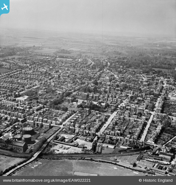
EAW022221 ENGLAND (1949). The town, Ryde, from the east, 1949
© Copyright OpenStreetMap contributors and licensed by the OpenStreetMap Foundation. 2026. Cartography is licensed as CC BY-SA.
Nearby Images (11)
EAW022221

EPW039641

EPW039640

EAW025806

EAW025807

EAW025804

EAW025805

EAW025802

EAW025803

EAW025801

EAW025808

Details
| Title | [EAW022221] The town, Ryde, from the east, 1949 |
| Reference | EAW022221 |
| Date | 17-April-1949 |
| Link | |
| Place name | RYDE |
| Parish | RYDE |
| District | |
| Country | ENGLAND |
| Easting / Northing | 459750, 92389 |
| Longitude / Latitude | -1.1533540087485, 50.727472110442 |
| National Grid Reference | SZ598924 |
Pins

Helen |
Monday 15th of January 2024 06:48:49 PM | |
|
Helen |
Monday 15th of January 2024 06:47:17 PM | |
|
Helen |
Monday 15th of January 2024 06:46:02 PM | |
|
Helen |
Monday 15th of January 2024 06:44:56 PM | |
|
Helen |
Monday 15th of January 2024 06:44:20 PM | |

Sparky |
Saturday 26th of August 2017 06:21:35 PM |