
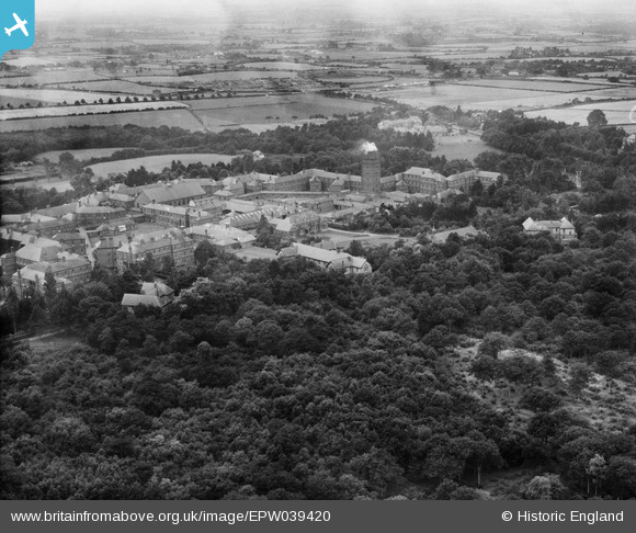
EPW039420 ENGLAND (1932). Hellingly Hospital and surrounding countryside, Hellingly, 1932
© Copyright OpenStreetMap contributors and licensed by the OpenStreetMap Foundation. 2026. Cartography is licensed as CC BY-SA.
Nearby Images (5)
EPW039420

EPW039426

EPW039425

EPW039421

EPW039422

Details
| Title | [EPW039420] Hellingly Hospital and surrounding countryside, Hellingly, 1932 |
| Reference | EPW039420 |
| Date | August-1932 |
| Link | |
| Place name | HELLINGLY |
| Parish | HELLINGLY |
| District | |
| Country | ENGLAND |
| Easting / Northing | 559731, 112520 |
| Longitude / Latitude | 0.27130481202351, 50.889496517309 |
| National Grid Reference | TQ597125 |
Pins

Dan Gregory |
Wednesday 4th of June 2014 03:11:27 PM |
User Comment Contributions
East Sussex County Asylum - Hellingly Hospital. Compact Arrow plan buildings by G.T. Hine, 1898-1903. Closed in 1994 and mostly demolished 2010-13 with some buildings retained as flats. Further reading: http://thetimechamber.co.uk/beta/sites/asylums/east-sussex-county-asylum-hellingly |
Dan Gregory |
Wednesday 4th of June 2014 03:34:43 PM |