
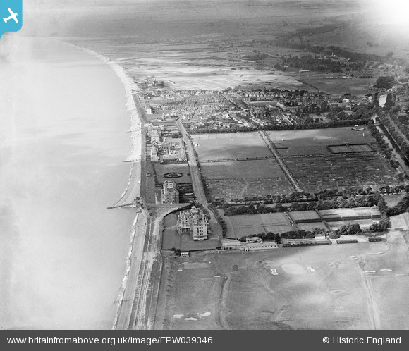
EPW039346 ENGLAND (1932). The Recreation Ground, South Road and environs, Hythe, from the north-east, 1932
© Copyright OpenStreetMap contributors and licensed by the OpenStreetMap Foundation. 2026. Cartography is licensed as CC BY-SA.
Nearby Images (5)
EPW039346

EPW000098

EPW000286

EPW026122

EPW026127

Details
| Title | [EPW039346] The Recreation Ground, South Road and environs, Hythe, from the north-east, 1932 |
| Reference | EPW039346 |
| Date | July-1932 |
| Link | |
| Place name | HYTHE |
| Parish | HYTHE |
| District | |
| Country | ENGLAND |
| Easting / Northing | 616987, 134486 |
| Longitude / Latitude | 1.097470411019, 51.068091311547 |
| National Grid Reference | TR170345 |
Pins

John Llewellyn |
Wednesday 9th of November 2016 01:08:18 PM |