
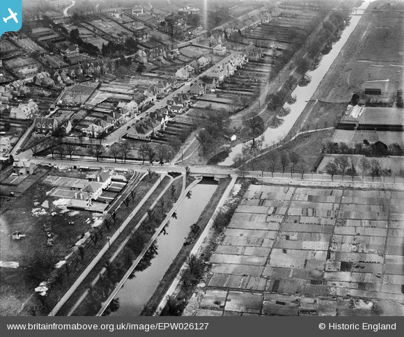
EPW026127 ENGLAND (1929). Twiss Road Bridge and the Royal Military Canal, Hythe, 1929
© Copyright OpenStreetMap contributors and licensed by the OpenStreetMap Foundation. 2026. Cartography is licensed as CC BY-SA.
Nearby Images (2)
EPW026127

EPW039346

Details
| Title | [EPW026127] Twiss Road Bridge and the Royal Military Canal, Hythe, 1929 |
| Reference | EPW026127 |
| Date | April-1929 |
| Link | |
| Place name | HYTHE |
| Parish | HYTHE |
| District | |
| Country | ENGLAND |
| Easting / Northing | 616761, 134727 |
| Longitude / Latitude | 1.0943937697467, 51.070340888842 |
| National Grid Reference | TR168347 |
Pins
Be the first to add a comment to this image!