
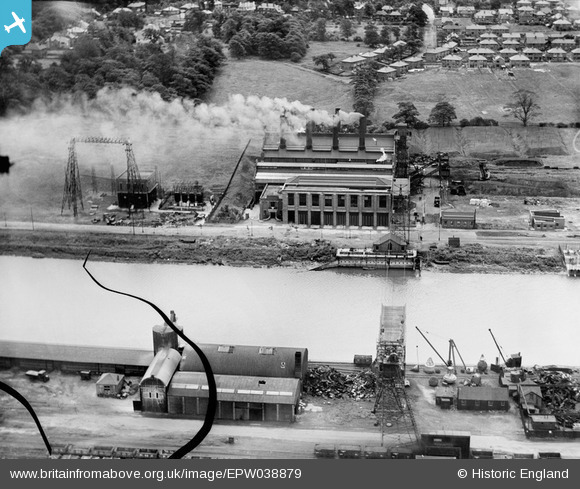
EPW038879 ENGLAND (1932). Preston Power Station on the River Ribble, Higher Penwortham, 1932. This image has been produced from a damaged negative.
© Copyright OpenStreetMap contributors and licensed by the OpenStreetMap Foundation. 2026. Cartography is licensed as CC BY-SA.
Nearby Images (9)
EPW038879

EPW038874

EPW038878

EPW038875

EPW038876

EPW038877

EPW007306

EPW038884

EPW055148

Details
| Title | [EPW038879] Preston Power Station on the River Ribble, Higher Penwortham, 1932. This image has been produced from a damaged negative. |
| Reference | EPW038879 |
| Date | July-1932 |
| Link | |
| Place name | HIGHER PENWORTHAM |
| Parish | PENWORTHAM |
| District | |
| Country | ENGLAND |
| Easting / Northing | 352190, 429209 |
| Longitude / Latitude | -2.7252281197406, 53.756825833973 |
| National Grid Reference | SD522292 |
Pins
Be the first to add a comment to this image!