
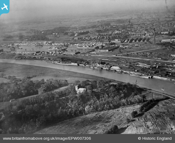
EPW007306 ENGLAND (1921). Albert Edward Dock and the River Ribble, Preston, from the south-east, 1921. This image has been produced from a copy-negative.
© Copyright OpenStreetMap contributors and licensed by the OpenStreetMap Foundation. 2026. Cartography is licensed as CC BY-SA.
Nearby Images (10)
EPW007306

EPW055148

EPW038878

EPW038879

EPW038874

EPW038876

EPW038875

EPW038877

EPW034072

EPW038884

Details
| Title | [EPW007306] Albert Edward Dock and the River Ribble, Preston, from the south-east, 1921. This image has been produced from a copy-negative. |
| Reference | EPW007306 |
| Date | 17-October-1921 |
| Link | |
| Place name | PRESTON |
| Parish | |
| District | |
| Country | ENGLAND |
| Easting / Northing | 352376, 429171 |
| Longitude / Latitude | -2.7224010787136, 53.756501311026 |
| National Grid Reference | SD524292 |
Pins
Be the first to add a comment to this image!