
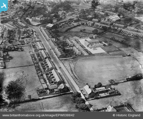
EPW038842 ENGLAND (1932). Cricket ground on Chatburn Road and environs, Clitheroe, 1932
© Copyright OpenStreetMap contributors and licensed by the OpenStreetMap Foundation. 2026. Cartography is licensed as CC BY-SA.
Nearby Images (2)
EPW038842

EPW058409

Details
| Title | [EPW038842] Cricket ground on Chatburn Road and environs, Clitheroe, 1932 |
| Reference | EPW038842 |
| Date | July-1932 |
| Link | |
| Place name | CLITHEROE |
| Parish | CLITHEROE |
| District | |
| Country | ENGLAND |
| Easting / Northing | 374732, 442372 |
| Longitude / Latitude | -2.3843827495611, 53.876726102099 |
| National Grid Reference | SD747424 |
Pins
Be the first to add a comment to this image!
User Comment Contributions
Chatburn Road, Clitheroe Cricket Club and Pendle Junior School. |

joanygee |
Sunday 17th of November 2013 01:18:51 PM |