
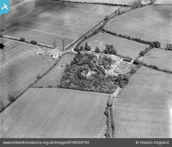
EPW038792 ENGLAND (1932). Coldhams Farm, Rickling, 1932
© Copyright OpenStreetMap contributors and licensed by the OpenStreetMap Foundation. 2025. Cartography is licensed as CC BY-SA.
Nearby Images (4)
EPW038792

EPW038790

EPW038791

EPW038789

Details
| Title | [EPW038792] Coldhams Farm, Rickling, 1932 |
| Reference | EPW038792 |
| Date | June-1932 |
| Link | |
| Place name | RICKLING |
| Parish | CLAVERING |
| District | |
| Country | ENGLAND |
| Easting / Northing | 549320, 231997 |
| Longitude / Latitude | 0.17375855973158, 51.965937012742 |
| National Grid Reference | TL493320 |
Pins
Be the first to add a comment to this image!