
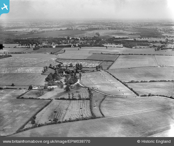
EPW038770 ENGLAND (1932). Poultry farming at Church End Farm, Rickling, from the west, 1932
© Copyright OpenStreetMap contributors and licensed by the OpenStreetMap Foundation. 2025. Cartography is licensed as CC BY-SA.
Nearby Images (5)
EPW038770

EPW038782

EPW038773

EPW038780

EPW038781

Details
| Title | [EPW038770] Poultry farming at Church End Farm, Rickling, from the west, 1932 |
| Reference | EPW038770 |
| Date | June-1932 |
| Link | |
| Place name | RICKLING |
| Parish | QUENDON AND RICKLING |
| District | |
| Country | ENGLAND |
| Easting / Northing | 549442, 231392 |
| Longitude / Latitude | 0.17526993461327, 51.960468113349 |
| National Grid Reference | TL494314 |
Pins
Be the first to add a comment to this image!